For the second time now, I found a WoGE by Ole Tjugen. Number 382 was – at first – a rather obvious piece of Swedish coast, but I didn’t realise the significance of this specific spot. Ole’s hint was too subtle for me, so he had to prod me into the right direction – the Ytterby mine of periodic table fame.
If you want to know what WoGE is, see below the fold. Previous WoGEs are collected by Felix on his blog and in a KML file.
I am not completely content with my new picture, because I had to blur the copyright notice. But otherwise it would give too many clues. (I’ll publish the complete image after it has been solved.) I invoke Schott’s rule, so newcomers (and people finding out about the new WoGE too late) have a chance.
Where on Google Earth #383. Click to embiggen.
For any new players to Where on (Google) Earth, simply post a comment with latitude and longitude and write something about the (geologic/geographic/geomorphologic) feature in the picture. If you win, you get to host the next one.
Schott's Rule is in effect: former winners have to wait for 1 hour for each WoGE they got right.
I will post some hints if there is no answer after some time.
Posted on 21 June, 23:00 CEST (21:00 UTC).
Have fun and good luck!

Comments 3
51.5938°, 14.5737° near Lake Felix, Germany
The "Muskauer Faltenbogen" is a glacial structure of the "Elster Kaltzeit" in Europe 320.000 to 400.000 years old (Kansan glaciation). Glaciers clinched the layers of sand and Lignite on a length of 40km to a horse shoe shaped folded structure. Pressure of the glacier and the end moraine deformed the underlying layers to folds.
There is a geological statepart about this: http://www.muskauer-faltenbogen.de/de/muskauer-faltenbogen.html
Lately we do have a lot of geological state parks in Germany. That's a really nice thing to have.
So this is the first WOGE with even my name on it 😀 . Lake Felix .....
Congratulations Felix, for finding this nice structure.
Sadly, that website is a bit lacking, especially in English…
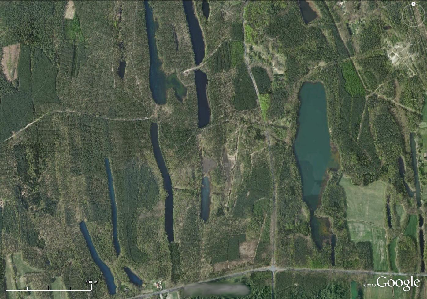
What’s special about the Muskau Fold Arch is not the deformation, but the combination with vasty different weathering rates of the sediments. The layers were not only folded, but thrust, so there are a lot of narrow, almoist vertical coal (lignite) seams. These coal seams lost volume because organic matter is easily decomposed close to the atmosphere, and – in the past few centuries – by mining. This process created the characteristic long narrow “valleys” called „Gieser“, which are often filled with lakes or fens. They nicely outline the Muskau Fold Arch, just zoom out a bit for the bigger picture.
The Felixsee is not in this picture, but not far away. Some years ago a lookout tower was built next to the lake, offering a nice view of the area.
WOGE 384 is at : http://woge-felix.blogspot.de/2013/06/where-on-google-earth-384.html
Post a Comment