When working on the local geology, I'm constantly reminded that in the former German Democratic Republic, topographic and geological maps were classified material.
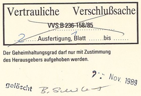
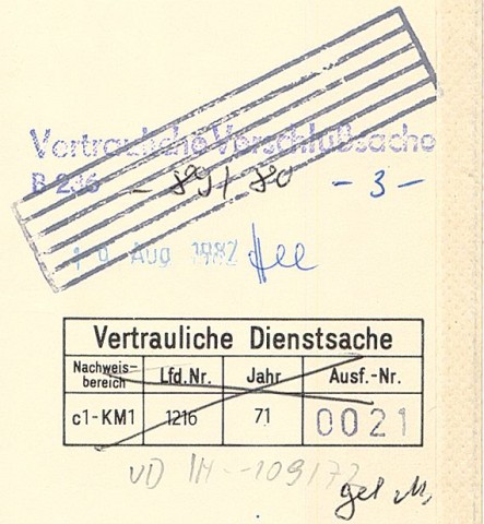
Most of the Lithofacies Map of the Quaternary 1:50000 (LKQ50) and the Hydrogeological Map 1:50000 (HK50) were ranked confidental („VD – Vertrauliche Dienstsache“, literally “confidential offical matter”), the rest was even secret1 („VVS – Vertrauliche Verschlußsache“, literally “confidential matter to be kept under lock and key”)

Classification marking on a Hydrogeological Map (map sheet 1009-1/2 Luckau/Lübben), map of groundwater vulnerability.

Classification markings on a Lithofacies Map of the Quaternary (map sheet 2068 Berlin SE). If I read this correctly, the original classification as VD from 1971 had been raised to VVS.
To access confidential matter, you needed the according clearance and the need to know. (VVS material was even kept in seperate locked archives and not to be removed from there.) Each individual copy was numbered and registered, so its use and whereabouts could be traced. Loosing maps could get you in real trouble, as my boss had experienced. (In that case, he had returned a map to the archive, but there it fell behind the drawer in the cabinet and therefore was reported as lost. This was discovered only later; in the meantime he was suspected to have contacts to the West German Geological Survey…)
Of course, you can't have confidential information lying around in large numbers. Each map sheet of the LKQ was printed about 30 times, sometimes even as low as 12 times2; the number of prints of the HK50 was approx. 80 to 100. After that, the printing plates were destroyed.

Information on LKQ map sheet 2168. „Auflagenhöhe“ = Number of prints.
Also, it might be dangerous to know where things are on a map. Hence, this rather peculiar restriction on the Lithofacies Map:

Remark on the LKQ50: “it is not permitted to draw a uniform coordinate grid”.
At least, they allowed the Hydrogeological Map to have a coordinate grid, which makes georeferencing rather easier.
Why?
Even the topographic maps used as base maps for the LKQ50 and HK50 were VD (confidential), and these were already from the redacted, less accurate “Edition for the National Economy” („AV – Ausgabe für die Volkswirtschaft“3), so the the classification of the derived geological maps could not be lower anyway.
Also, I guess, data on raw materials and groundwater, which could be gained from the maps, where sensitive information in this state which aimed to be self-sustaining despite being a bit short on mineral and water resources. The LKQ50 even contains the borehole locations, which can be revealing: if there's a cloud of boreholes with 200 metre spacing, there must be something interesting below the surface. Finally, the groundwater vulnerability map of the HK50 includes concrete information on hazards, e.g. chemical industry. You don't want the class enemy learn about these.
- I couldn't find a translation for this, or an overview of GDR classification levels. The translation of VD is taken from Lothar Mertens' article on dissertations; VVS as “secret” is based on mapping the 4 GDR levels NfD, VD, VVS and GVS onto the 4 English levels restricted, confidential, secret, top secret, explained in the Wikipedia article on classfied information. [↩]
- The lowest figure I have encountered so far. [↩]
- As opposed to the Edition for the State, „AS – Ausgabe für den Staat“ [↩]

Post a Comment